

Telephone Road Mobility has moved from a grant-funded corridor proposal into a near-term civic issue for District I residents as of October 13, 2026. The central change is not a single traffic adjustment; it is a planned rehabilitation of a 2.8-mile corridor that the City of Houston described after the U.S. Department of Transportation awarded Houston $20.96 million through the RAISE grant on August 10, 2022, for the Telephone Road: Main Street Revitalization Project Houston Planning release. For residents, schools, transit riders, pedestrians, cyclists, and small businesses along the corridor, the practical question is how the city converts that funding into safer crossings, usable sidewalks, better bus access, and drainage work without losing public trust during design and construction.
Telephone Road Mobility Scope And Funding
What Telephone Road Mobility Funds
The City of Houston Planning and Development Department said the grant-supported project includes upgraded sidewalks, bus stops, protected bike lanes, street crossings, safety treatments, median refuge islands at nine intersections, and CCTV cameras at three rebuilt intersections. The same city release said crosswalks would be restriped, corners tightened to improve visibility and speed control, and curb and drainage improvements made to bring underground drainage infrastructure up to modern standards. Those details matter because the corridor’s problems are not limited to pavement condition; they involve how people move between homes, bus stops, storefronts, schools, and civic services.
For District I, Telephone Road Mobility is best understood as a corridor repair program with several overlapping public purposes. Sidewalk upgrades address pedestrian access. Bus stop work addresses transit reliability and boarding conditions. Protected bicycle infrastructure, if delivered as described in the city’s grant announcement, would separate some bicycle movement from vehicle lanes. Drainage work addresses a basic public works concern that affects roadway durability and street-level access after heavy rain. Each component has a different measure of success, so residents should expect the city to report progress in more than one category.
Subproject Timing And Budget Signals
City project materials for the Telephone Road Main Street Revitalization Subproject 1 identify Council District I as the relevant district, list a $5.94 million budget, and state that work was set to begin in fall 2026 with an estimated completion date in fall 2027. Because October 13, 2026, falls within that stated start window, residents should treat schedule information as time-sensitive and verify notices from the city before planning around construction access, lane changes, or sidewalk closures. The available research supports the expected timing and budget, but it does not establish from the allowed official sources whether ground work had already started by October 13, 2026.
The budget information also points to a common civic challenge: a corridor-wide vision often advances through narrower construction packages. That can help the city stage work, but it can also make it harder for residents to see how one block’s sidewalk or drainage segment fits the full corridor. Clear public reporting should distinguish between grant-funded corridor goals, subproject budgets, construction contracts, and any later city-funded additions.
District I Impacts From Telephone Road Mobility
Safety Benefits Depend On Design Details
District I impacts will likely be judged first by daily safety conditions. The Houston Police Department reported that a 62-year-old man was killed in a hit-and-run crash on the 6100 block of Telephone Road on August 7, 2026, and that the investigation was announced on August 10, 2026 Houston police notice. That official notice does not evaluate the mobility project, and it should not be used to assign design conclusions by itself. It does, however, document that severe pedestrian risk remained a live public safety concern on Telephone Road in August 2026.
Design measures named by the city can respond to several known street-safety mechanisms. Restriped crosswalks can make pedestrian paths clearer. Tightened corners can reduce turning speeds and improve sight lines. Median refuge islands can allow a person crossing a wide street to pause between directions of traffic. Bus stop upgrades can reduce the need for riders to wait in damaged or inaccessible areas. None of these measures guarantees a specific safety outcome on its own, and public agencies should avoid claiming results before post-construction data exist. Still, the city’s stated package is aimed at the types of conflicts residents experience on arterial streets.
Access For Transit Riders, Walkers, And Small Businesses
Sidewalk and bus stop conditions affect whether residents can safely reach transit, neighborhood shops, parks, schools, and public services. The city’s Planning and Development Department identified bus stops and sidewalks as project elements, which places the work within daily mobility rather than only traffic throughput. For residents without reliable access to a private vehicle, gaps in sidewalks or unsafe crossings can function as barriers to work, appointments, school activity, and civic participation.
Small businesses may face short-term construction friction if access, parking, or deliveries are temporarily affected. The research provided here does not include an official block-by-block construction phasing plan, so those impacts cannot be predicted with precision. A cautious civic approach would ask the city to publish accessible construction notices, maintain pedestrian routes where feasible, coordinate with transit providers, and give storefronts clear points of contact for access problems. For readers comparing how civic and business organizations share public-project information across communities, the related site in the same network, Richland Chamber network, offers a useful reference point, while Houston decisions remain tied to city departments and District I representation.
Drainage, Heat, And Public Space Conditions
Drainage Work As Basic Civic Infrastructure
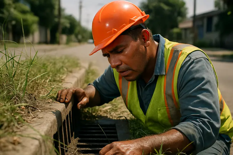
The city’s grant announcement included curb and drainage improvements, including bringing underground drainage infrastructure up to modern standards. In practical terms, drainage is not a secondary feature. Poor drainage can shorten pavement life, make curb ramps difficult to use, and leave pedestrians and transit riders exposed to standing water near intersections. Because the city release does not provide engineering drawings in the research supplied here, residents should be cautious about assuming which blocks will receive the most visible drainage changes or how quickly standing-water conditions may improve.
Drainage work also intersects with environmental stewardship in a local, practical way. A street that manages runoff better can reduce routine ponding and may support safer walking and transit access after rain. The available source material does not support claims about specific flood-depth reductions, water-quality gains, or climate outcomes, so those should remain questions for project engineers and public works staff. The useful civic request is for the city to explain how new curbs, inlets, underground drainage, sidewalks, and bus stop areas will function together during ordinary storms and heavier rain events.
Public Space Quality Without Tourism Framing
Telephone Road is a working civic corridor, not a project that should be measured by visitor appeal. Wider, passable sidewalks and safer crossings can change how residents experience routine errands, school travel, bus trips, and access to public meetings or services. Landscaped buffers, where included in final designs, may create more separation between moving vehicles and people walking. The research does not confirm final design details for every segment, so residents should distinguish between announced grant elements, later design revisions, and construction-ready plans.
- Ask city staff which intersections will receive median refuge islands and rebuilt signal or camera infrastructure.
- Request a block-level sidewalk and curb-ramp map before construction begins on each segment.
- Track whether bus stop access is maintained during construction and improved after completion.
- Ask for drainage design explanations in plain language, including where runoff will go during heavy rain.
Telephone Road Mobility Questions For District I
Measures Residents Can Track
Telephone Road Mobility should be evaluated through public measures that match the city’s stated goals. For safety, that means post-construction crash data, with attention to pedestrians and cyclists as well as vehicle occupants. For access, that means completed sidewalk segments, usable curb ramps, crosswalk visibility, bus stop conditions, and travel paths during construction. For drainage, that means documented locations where curb and underground improvements were made, along with resident-facing explanations of expected performance.
A key caveat is that the available official material confirms project intent and selected components, not final outcomes. District I residents should therefore watch council agendas, city project notices, public works updates, and any community meeting materials tied to Subproject 1. The civic next step is not simply to support or oppose a corridor idea in broad terms. It is to ask whether the built project matches the funded scope, whether any design changes are explained in public, and whether residents most affected by construction receive timely information in usable formats.
Because Telephone Road Mobility sits at the intersection of safety, drainage, transit access, and neighborhood commerce, the project’s public value will depend on execution. The grant award established a funding base in 2022, and city project materials placed Subproject 1 within the fall 2026 to fall 2027 window. The practical test for District I is whether the work produces safer crossings, more reliable walking and bus access, and drainage improvements that residents can observe and public agencies can document.